Talas (Talas)
Talas is a town in northwestern Kyrgyzstan, located in the Talas river valley between two mountain ranges. Its area is 13 km2, and its resident population was 40,308 in 2021. It is the administrative headquarters of Talas Region. The town was founded by East Slavic settlers in 1877. To the south is the Besh-Tash (‘five rocks’) valley with the Besh-Tash National Park.The Historic Battle of Talas was also fought here between the armies of the Abbasid Caliphate and the Tang Dynasty in 751. The Abbasids defeated the Chinese Empire.
Its economy has traditionally been oriented towards the ancient city of Taraz (formerly named Talas and Dzhambul) in present day Kazakhstan. The Talas valley has suffered severely from the imposition of rigid border controls by Kazakhstan following the demise of the Soviet Union, as transport and trade links to the rest of Kyrgyzstan are now constrained by the mountains separating it from the Chüy Valley and Bishkek. Though much transportation does occur from Bishkek to Talas by transiting through Kazakhstan via the border crossings at Chaldybar in Chüy and then re-crossing into the Talas valley of Kyrgyzstan at Taraz. The only drivable road within the borders of Kyrgyzstan to Bishkek and the rest of the country crosses two mountain passes that rise to heights of more than 3000 meters above sea level over the Ötmök Pass into the Suusamyr Valley and then again the Töö Ashuu Pass before descending to the Chüy Valley and Bishkek.
Its economy has traditionally been oriented towards the ancient city of Taraz (formerly named Talas and Dzhambul) in present day Kazakhstan. The Talas valley has suffered severely from the imposition of rigid border controls by Kazakhstan following the demise of the Soviet Union, as transport and trade links to the rest of Kyrgyzstan are now constrained by the mountains separating it from the Chüy Valley and Bishkek. Though much transportation does occur from Bishkek to Talas by transiting through Kazakhstan via the border crossings at Chaldybar in Chüy and then re-crossing into the Talas valley of Kyrgyzstan at Taraz. The only drivable road within the borders of Kyrgyzstan to Bishkek and the rest of the country crosses two mountain passes that rise to heights of more than 3000 meters above sea level over the Ötmök Pass into the Suusamyr Valley and then again the Töö Ashuu Pass before descending to the Chüy Valley and Bishkek.
Map - Talas (Talas)
Map
Country - Kyrgyzstan
 |
 |
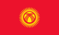
| Flag of Kyrgyzstan | |
Ethnic Kyrgyz make up the majority of the country's 6.6 million people, followed by significant minorities of Uzbeks and Russians. The Kyrgyz language is closely related to other Turkic languages.
Currency / Language
| ISO | Currency | Symbol | Significant figures |
|---|---|---|---|
| KGS | Kyrgyzstani som | Ñ | 2 |
| ISO | Language |
|---|---|
| KY | Kirghiz language |
| RU | Russian language |
| UZ | Uzbek language |


